
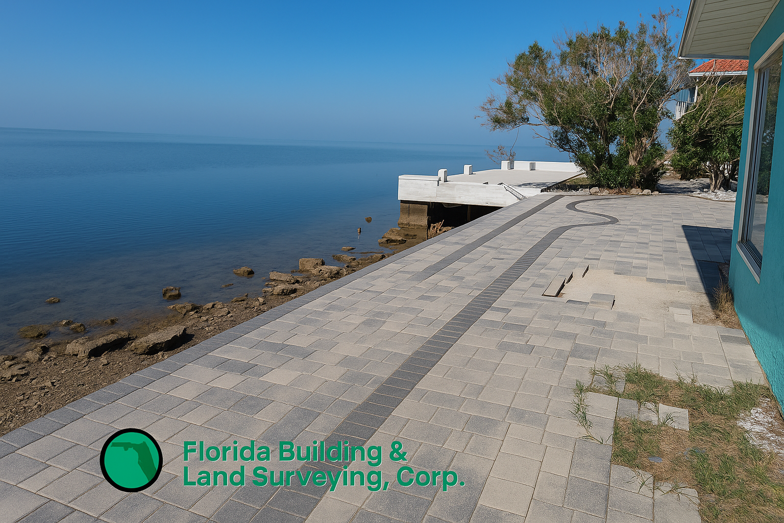
There’s something special about surveying a property with panoramic views of the Gulf of Mexico, and our recent boundary survey and elevation certificate project in Hernando Beach, Florida was a perfect example. Situated along the coast, this waterfront home offered stunning sunsets, peaceful water views, and a serene environment that made our fieldwork both enjoyable and unforgettable. While the setting was picturesque, the importance of accurate land surveying in coastal areas can’t be overstated.
Conducting a Boundary Survey in Hernando Beach
A boundary survey is essential for establishing the exact property lines and confirming legal boundaries. With water-adjacent lots, like in Hernando Beach, precise measurement is critical due to seawalls, docks, and fluctuating tidal influences. During our survey, we:
- Located property corners and verified lot dimensions
- Identified improvements including fences, seawalls, and waterfront structures
- Checked for possible encroachments and easements
- Mapped visible utilities and access routes
This property’s proximity to open water meant additional attention was needed to verify boundary markers and ensure accuracy based on the recorded plat—common in surrounding areas such as Spring Hill, Weeki Wachee, Hudson, and Aripeka, where canal-front and Gulf-facing homes are prevalent.
What Is an Elevation Certificate and Why Is It Needed?
In coastal regions like Hernando Beach and other areas near Port Richey, Homosassa, and Crystal River, many properties fall within FEMA-designated flood zones. An elevation certificate (EC) provides official documentation of a structure’s elevation relative to the Base Flood Elevation (BFE).
Here’s why elevation certificates are essential:
- Required for flood insurance under the National Flood Insurance Program (NFIP)
- Helps determine accurate insurance rates
- Ensures compliance with FEMA and local building regulations
- Required for new construction, major improvements, and rebuilding after damage
- Allows homeowners to better understand their risk and mitigate potential flood issues
As part of our elevation certification process, we established vertical control using known benchmarks and confirmed the elevation of the lowest structural elements. Even a small elevation difference can drastically affect flood risk in waterfront communities like Bayport, Pine Island, and the broader Hernando County coastline.
The Challenges and Beauty of Coastal Land Surveying
Surveying along the Gulf Coast presents unique challenges—wind exposure, tidal changes, and saltwater corrosion—but the rewards are unmatched. During our work in Hernando Beach, we enjoyed breathtaking natural scenery, including calm water views and occasional sightings of marine wildlife. Similar challenges exist when surveying near Tarpon Springs, Clearwater Beach, and New Port Richey, where elevation, storm surge impact, and construction limitations require careful assessment.
Why Choosing an Experienced Florida Land Surveyor Matters
When working with waterfront and flood-zone properties, hiring a licensed surveyor familiar with coastal surveying is essential. A professional ensures accuracy, regulatory compliance, and peace of mind—especially when preparing elevation certificates or planning new construction in areas like Pasco, Citrus, and Hernando counties.
Whether you’re buying, building, or remodeling a property in Hernando Beach or nearby communities, completing your boundary survey and elevation certificate early in the process will help you avoid costly delays and insurance complications.
Final Thoughts
This surveying project in Hernando Beach, FL was not only technically rewarding but also visually inspiring. While the captivating Gulf views reminded us why coastal property is so desirable, the survey underscored how vital accuracy is to protecting that investment.