
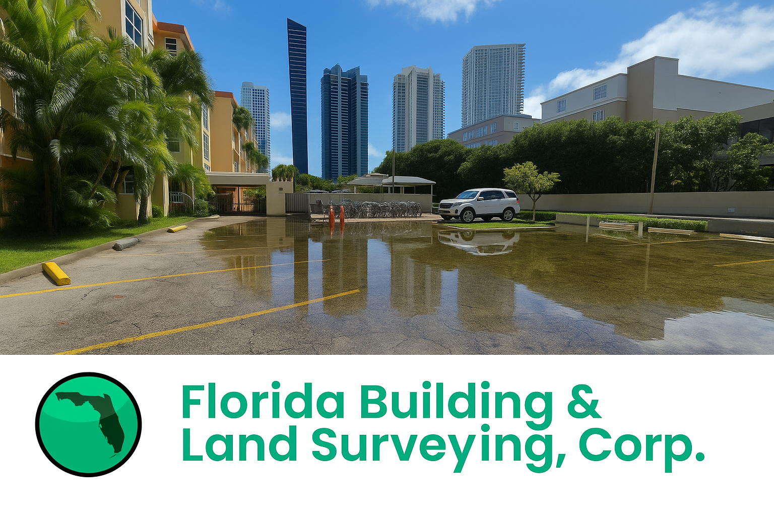
Flooding is one of the most persistent challenges faced by South Florida property owners, especially in low-lying coastal areas like Sunny Isles, Florida. When rainstorms strike, properties without proper grading or drainage quickly become overwhelmed. That’s where precise land surveying and drainage design come in.
Recently, Florida Building & Land Surveying under the direction of Rick Morales, PSM, completed a comprehensive topographic survey in Sunny Isles for a client experiencing repeated flooding and standing water after heavy rains. The survey provided the essential data framework our engineering department needed to design an effective drainage plan that will prevent future flooding and improve overall site performance.
Why a Topographic Survey Is the Foundation for Flood Prevention
A topographic survey is a detailed mapping of the surface features and elevations of a property. For drainage and flood prevention projects, this data is critical—it shows how water moves (or fails to move) across a site.
In the case of our Sunny Isles client, stormwater had been collecting in low areas of the property due to uneven grading. Without accurate elevation data, it’s nearly impossible for engineers to design a proper drainage solution. By performing a professional topographic land survey, our team provided the precise elevation contours, spot grades, and utility features necessary for developing a reliable engineering drainage design.
This survey will now guide our engineers in designing new swales, inlets, and grading improvements to redirect water away from the structure and prevent flooding from recurring.
Our Surveying Process: Step-by-Step Precision
Performing a topographic survey for drainage design requires technical skill, modern equipment, and careful attention to detail. Every project we complete follows a proven process to ensure accuracy and consistency from fieldwork to engineering design.
- Project Research and Control Setup
Before fieldwork began, our surveying team, led by Rick Morales, PSM, reviewed property records, prior plats, and boundary information to establish horizontal and vertical control. Using the Florida State Plane Coordinate System, we ensured all elevation and coordinate data were geodetically accurate and tied to local benchmarks.
- Field Data Collection
Our field crew utilized high-precision GNSS GPS and robotic total stations to collect thousands of elevation points across the site. We mapped all relevant features—structures, driveways, utilities, vegetation, and drainage elements—while capturing the subtle slopes and depressions that affect stormwater movement.
Where access was limited, we employed reflectorless total station measurements to capture hard-to-reach data safely and efficiently. Every elevation point collected helps form the foundation of the engineering-grade digital terrain model (DTM) used for design.
- Quality Control and Data Processing
Back at our office, the raw data underwent a comprehensive quality assurance review. Our CAD technicians processed the information into an accurate topographic contour map, clearly depicting how water naturally flows across the site.
- Engineering Integration
The completed survey was delivered to our engineering department, which is now developing a drainage plan based on the survey data. This design will regrade select areas, add drainage inlets, and establish new flow paths that prevent ponding and move stormwater safely off-site.
How Survey Data Becomes a Drainage Solution
With the Sunny Isles topographic survey completed, our engineers analyzed the contours and determined that improper site grading was the primary cause of the flooding. The elevation model revealed several low-lying areas where water accumulated after rain events.
By leveraging this accurate survey data, the engineering drainage design will include regraded surfaces, added drainage structures, and improved slopes—all calibrated to prevent runoff from flowing toward the home or neighboring properties.
This collaboration between surveying and engineering ensures that every drainage plan we design is both data-driven and field-verified, minimizing risk and maximizing long-term results for the property owner.
Why Accurate Land Surveying Matters in Flood-Prone South Florida
In Miami-Dade and Broward Counties, even a small elevation error can mean the difference between a dry yard and a flooded property. A professional land surveyor in Sunny Isles can capture these subtle elevation changes and provide the precise information needed to build drainage systems that actually work.
At Florida Building & Land Surveying, we understand that flood prevention starts with accurate data. Whether it’s a residential home or a commercial site, our surveys and drainage designs work together to protect properties, improve resilience, and support sustainable development across South Florida.
Building a More Resilient Future
This Sunny Isles topographic survey is more than just another project—it’s a blueprint for resilience. With precise data collected by our experienced team and engineering expertise led by Rick Morales, PSM, our client can move forward confidently, knowing that the root causes of their flooding issue are being addressed scientifically and permanently.
As sea levels rise and heavy rainfall events become more frequent, accurate topographic surveying and drainage design will continue to be the first line of defense for property owners throughout South Florida.
About Florida Building & Land Surveying
Florida Building & Land Surveying Corp. is a licensed professional surveying and engineering firm serving all of Florida’s 67 counties. Led by Rick Morales, PSM, the firm specializes in boundary surveys, topographic surveys, construction layout, and drainage design.
Our mission is to deliver accurate data, responsive service, and engineering solutions that help clients build safely, sustainably, and flood-free.
Visit www.floridalandsurveying.com to learn more about our topographic survey services in Florida.